

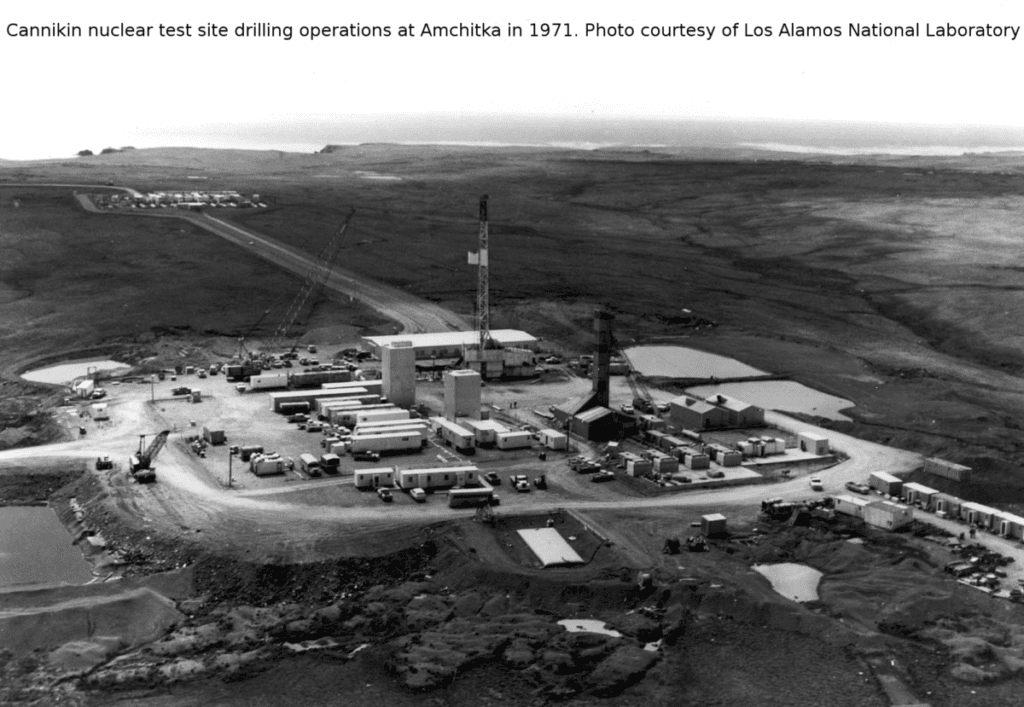
At Amchitka, the United States conducted three massive underground nuclear tests between 1965 and 1971. The largest–code-named Cannikin–exploded with a destructive power 400 times larger than the atomic bomb dropped on Hiroshima during World War II.
Contaminant Cleanup – Amchitka Island
The following is adapted from a poster presentation by Jordan H. Stout, US Fish & Wildlife Service Environmental Contaminants Program, Anchorage Field Office: Contaminated military sites on National Wildlife Refuges in Alaska.
Background
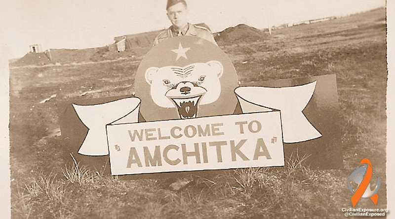
Amchitka Island in the central Aleutian Islands was drafted into military service during World War II. This island in the Alaska Maritime Refuge became a forward fighter and bomber base for the Allies in January of 1943 in the campaign to recapture the Japanese-held islands of Attu and Kiska. The facilities included living quarters, roads, runways and infrastructure to support dozens of fighter planes and, bombers, as well as15,000 troops stationed there.
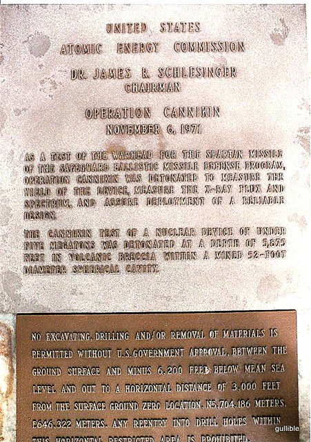
Cold War era activities on Amchitka included a White Alice Communications Site (1959-61) and underground nuclear testing including the Longshot (1965), Milrow (1969) and Cannikin Projects (1971). At nearly five megatons, the Cannikin blast was the largest underground nuclear test ever performed by the United States.
A Relocatable Over The Horizon Radar (ROTHR) surveillance facility was operated on Amchitka from 1987 until the system was abandoned but left in place in 1993. The island has remained deserted since 1993 and no development (military or otherwise) is anticipated.
Contaminant Issues
The historic events left nearly 75 contaminated sites on Amchitka under three responsible parties: U.S. Army Corps of Engineers, U.S. Department of Navy and Department of Energy.
- Some of the cleanup issues include chemicals, ordnance, contaminated drilling muds and radionuclides. Chemicals in groundwater and soil include petroleum products as well as solid and hazardous wastes. Sewage sludges in the sewage lagoon contain polychlorinated biphenyls (PCBs) at levels up to 463 ppm.
- DDT-related compounds have been found in peregrine falcons, bald eagles and sea otters from Amchitka, although the source of these compounds is not clear.
- Thirty-nine potential ordnance sites have been found, including practice ranges, defensive positions and storage and disposal areas.
 The underground nuclear testing program on Amchitka produced well over 100,000 cubic yards of drilling muds contaminated with chromium, diesel fuel and PCBs. About 40,000 cubic yards of these drilling muds were contained within open reserve pits, many of which attracted waterfowl and had been known to fail, spilling contaminated drilling muds into adjacent wetlands and stream reaches.
The nuclear testing program also produced radionuclides, some of which (tritium) were released during the Longshot blast and some of which may be released to the biosphere in the coming years. The timing, location and extent of future releases of other more persistent radionuclides are currently unknown.
Cleanup Actions
A 2001 cleanup involved 200 people at a cost of more than $20 million. The Navy demolished 60 abandoned structures and facilities; removed 47 fuel storage tanks; treated 2,500 cubic yards of petroleum-contaminated soils; and remediated the sewage lagoon by shipping 2,000 cubic yards of PCB-contaminated sludges off-island for incineration.
The Corps used historic records, computer-aided aerial photographic interpretation techniques and on-the-ground geophysical surveys to understand the nature and extent of the ordnance contamination on Amchitka.
- Napalm
- 60 and 81 mm mortars
- grenades
- anti-personnel mines
- 4, 20, 100, 250 and 500 pound bombs or casings
- incendiary bomblets
- 20, 37, 90 and 155 mm projectiles
- various other smaller items
The Department of Energy closed 12 drilling mud pits and, an underground storage tank, and is currently developing a groundwater model and long-term marine monitoring program for Amchitka to address potential radionuculide-related contamination issues.Contaminant Legacy – Amchitka Island
“The likely path of radiation leakage is thought to be freshwater coming down on the island as rain and runoff and percolating down through the blast sites and then slowly seeping, diffusing out underneath the ocean floor and coming up under the ocean,” Johnson said.
“There were no indications of any radioactive leakage, and all that was really wonderful news,” said Johnson. “If there had been leakage, it would be a whole new ballgame. But we are delighted to learn that at this time there is no evidence that these blast sites have done anything but contain the radioactive material.”
Because Amchitka lies within a geologically active region, where earthquakes and volcanic eruptions are common, a long-term research and monitoring program is essential.
“Most scientists I know are convinced that we need to visit this site every several years,” Johnson said. “We are obligated as a species to go there and keep testing and keep looking to understand the implications of what (the nuclear tests) have done and to make sure we haven’t contaminated the environment.”
Relevant Links
- http://inthesetimes.com/projectcensored/stclair2317new.html
- http://www.cdc.gov/niosh/ocas/amchitka.html
- Amchitka – Record of Decision 2008
- UAF Report on Amchitka 2006
Click to Subscribe to the Civilian Exposure Newsletter for Latest News & Updates Today!